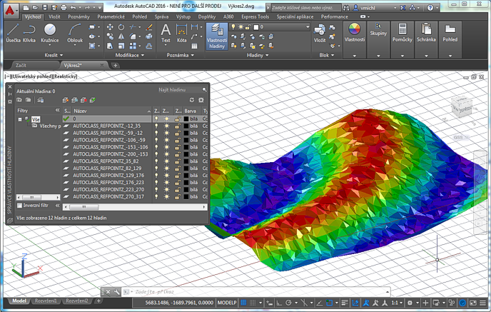
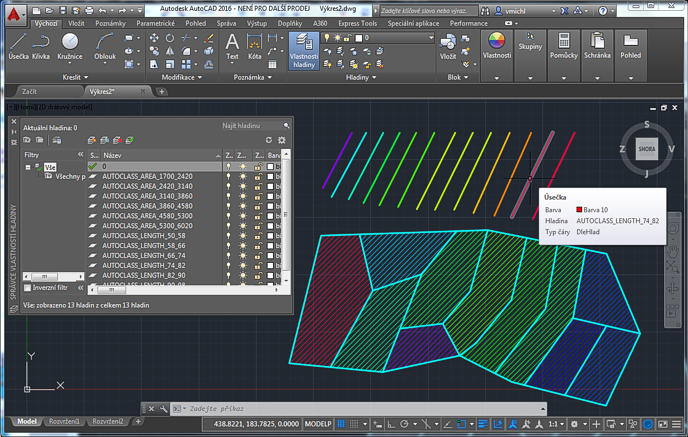
CAD Forum - tips, tricks, discussion and utilities for AutoCAD, Inventor, Revit and other Autodesk products [www.cadforum.cz]
CZ | EN | DE
Login or
registration
  Visitors: 21576

CAD tip CAD tip # 10682:

   
Question CAD 
 %  platform  category 
Q - question

Automatic classification of drawing objects by their properties.

A - answer In some workflows, you may need to process your AutoCAD drawing so that it would be easier to separate (visually or by selection) individual objects having identical or similar properties. This classification is a standard functionality in GIS versions of AutoCAD (Map and Civil 3D), but you can partially use it also in plain AutoCAD and its other vertical versions:

With the CADstudio AutoClass utility you can dissect selected objects to separate categories (classes) by one of their common properties - e.g. elevation, area, length, volume, radius, rotation, attribute value etc. Individual categories (classes) can be then represented either by color hue (preset palettes are part of the application - rainbow, hydro, greens, pastels...), or by automatically created layers - like AUTOCLASS_RADIUS_10_19, AUTOCLASS_RADIUS_20-29, etc. You can also use special properties RefPointZ (Z-coordinate of object's reference point) or PtDistance (distance of an object to a specified point).

The add-on is easy to use. Download AutoClass from Download, load the file AUTOCLASS.VLX using the APPLOAD command or using ACADDOC.LSP and enter the command AUTOCLASS. Select the objects (of similar types) and AutoClass offers the classification by their common properties. After you select the property, AutoClass scans selected objects and finds minimum and maximum values of that property (the extremes). Choose the color- or layer-based classification method. For color-classification, pick one of the preset palettes. For layer-classification, specify either the number of classes or their ranges (size, interval). Layers in the format:

AUTOCLASS_property_from_to

will be created automatically and appropriate objects will be moved into them.

AutoClass can be used e.g. to color terrain model (3DFACEs), separate points by their elevation, mark parcels by their lot area, blocks by the values of their attribute (e.g. price), or 3D solids by their volume.

AutoClass in a limited version is available for free, full version can be unlocked by entering the authorization code.

More on the AutoClass homepage

ACADADTACADMPlantCivilMap
100% *  CAD 
8.1.2016    14986×  

See also:
Tip 11933:Color separation of building levels in Autodesk ReCap point cloud.
Tip 9935:How to distinguish between an assembly and weldment in VBA or iLogic?


Back   All CAD Tips


Have we helped you? If you want to support the CAD Forum web service, consider buying one of our CAD applications, or our custom software development offerings, or donating via PayPal (see above). You may also add a link to your web - like this "fan" link: CAD Forum - tips, utilities, blocks for Autodesk products
CAD:    OS:    Categ: 
Text:  FAQ glossary   


Featuring:
DwgTextTranslator translates a series of drawings from one language to another using MS Access.
Download a fully functional trial version.


Please use these tips at your own risk.
Arkance Systems is not responsible for possible problems that may occur as a result of using any of these tips.
TOPlist