CAD Forum - Database of tips, tricks and utilities for AutoCAD, Inventor and other Autodesk products [www.cadforum.cz]
CZ | EN | DE
Login or
registration
  Visitors: 12043
RSS channel - CAD tips RSS tips
RSS discussions

Discussion Discussion forum


HelpCAD discussion

 
CAD Forum - Homepage CAD discussion forum - ask any CAD-related questions here, share your CAD knowledge on AutoCAD, Inventor, Revit and other Autodesk software with your peers from all over the world. To start a new topic, choose an appropriate forum.

Please abide by the rules of this forum.

How to post questions: register or login, go to the specific forum and click the NEW TOPIC button.
  FAQ FAQ  Forum Search   Events   Register Register  Login Login

Topic ClosedHow to read coordinates

 Post Reply Post Reply
Author
vijayasuresh View Drop Down
Newbie
Newbie


Joined: 11.Dec.2012
Location: United Arab Emirates
Using: AutoCAD2013
Status: Offline
Points: 3
Direct Link To This Post Topic: How to read coordinates
    Posted: 31.Jan.2013 at 16:29
Friends, 
In our CAD drawings the coordinates are mentioned as below
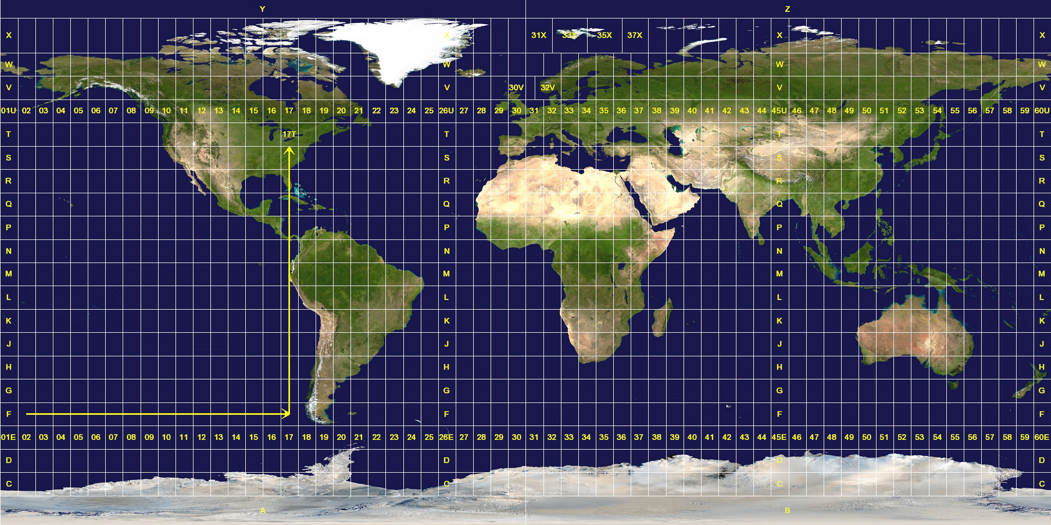
Easting:761725.23 and Northing:3352398.89

can one help me in identifying the coordinate format and any solution to convert this back to GPS coodinates.

Rgds,
Suresh
Suresh
Back to Top
heinsite View Drop Down
Senior Member
Senior Member


Joined: 05.Feb.2009
Location: United States
Using: AutoCAD 2014
Status: Offline
Points: 640
Direct Link To This Post Posted: 01.Feb.2013 at 02:19
The first step in something like this is to confirm the Geodetic Datum for the coordinates.  If these points are in the UAE that would be the Trucial Coast 1948 datum.  http://georepository.com/datum/browse/id/6303

If you now want to convert these to Lat-Long geographic values you'll need to find a converter.  Unfortunately the CORPSCON converter we use in the USA won't work... so you'll have to find something else.  One place might be here:

http://georepository.com/crs_30339/TC-1948-UTM-zone-39N.html

but if not you'll need to keep looking.

Another suggestion would be for you to find and talk to a local surveyor.  They will certainly be able to point you in the right direction if the ideas above don't work.

Good luck!
Dave.
Dave Hein, P.E.
Hawaii District Engineer
Kona International Airport
AutoCAD Certified Professional
Autodesk Expert Elite
Back to Top
vijayasuresh View Drop Down
Newbie
Newbie


Joined: 11.Dec.2012
Location: United Arab Emirates
Using: AutoCAD2013
Status: Offline
Points: 3
Direct Link To This Post Posted: 04.Feb.2013 at 14:54
Thanks Dave...

Rgds,
Suresh
Suresh
Back to Top
jmontesmx View Drop Down
Senior Member
Senior Member


Joined: 28.Jan.2008
Location: Mexico
Using: AutoCad2017
Status: Offline
Points: 113
Direct Link To This Post Posted: 08.Feb.2013 at 01:25

Your coordinates are in a global geographic coordinate system called Universal Transversal de Mercator that use the ellipsoid WGS84  that handles any GPS, you can enter your coordinates in AutoCAD as a point X to East, and Y to North, an easy way to change your latitude and longitude coordinates is joining Google Earth, locate the point with the coodinates that you have, go to the options menu and change your UTM coordinates as you want, you track the Log-point and apply for their properties and you will see the coordinates and changed.

I don't know if this is exactly that you want, hope that will help you.
Back to Top

Related CAD tips:


 Post Reply Post Reply
  Share Topic   

Forum Jump Forum Permissions View Drop Down


This page was generated in 0,453 seconds.