

 CAD tip # 9255:

|
| Question | CAD % platform category |
||||||||
|---|---|---|---|---|---|---|---|---|---|
|
|
||||||||
") AutoCAD
AutoCAD| See also: | |
| Tip 14017: | Voronoi diagrams in AutoCAD. |
| Tip 8754: | Thumbnail settings can influence AutoCAD DWG file size. |
| Tip 8716: | How to increase capacity of your SSD disk by several gigabytes? |
| Tip 8479: | How to generate 3D surface with a mathematic expression? |
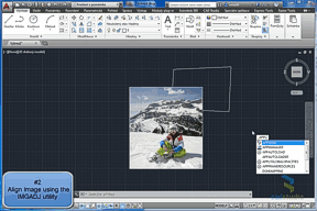
| Tip 7855: | Transforming raster images to multiple points. |
Selected tip:
List all hyperlinks in your DWG drawing.
How to borrow a network license in 3ds Max Design? « | » How much faster is Inventor 2014 Express mode than a standard assembly open?
Have we helped you? If you want to support the CAD Forum web service, consider buying one of our CAD applications, or our custom software development offerings, or donating via PayPal (see above).
You may also add a link to your web - like this "fan" link:
|
|
|
Featuring: Increase your productivity with our set of BIM add-on functions for Autodesk Revit CADstudio Revit Tools 
|
Please use these tips at your own risk.
Arkance Systems is not responsible for possible problems that may occur as a result of using any of these tips.
|
Arkance Systems CZ s.r.o. (CAD Studio) - Autodesk Platinum Partner & Training Center & Consulting Services Partner
|
CONTACT:
webmaster.cz@arkance-systems.com tel. +420 910 970 111 |
||
| Copyright © 2024 | Advertise with us | Online privacy |
| ||
