Neither the command IMAGE nor IMGATTACH allow to select multiple raster image files at the same time. Mostly it is even not desirable, as you will still need to specify the insertion point and scale for the individual images.
But of you insert (attach) e.g. georeferenced raster maps, you can benefit from mass insertion of the images and their subsequent mass positioning and rotation. All in one go, in a single AutoCAD command.
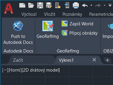
The freeware application GeoRefImg offers (since version 3.1) the command IMAGESATTACH, (the ribbon Add-ons > GeoRefImg > Attach Images) which can be used to multi-select attach many images in one go. Select the bitmap image files from the folders in the left panel one by one. They can be in different formats. After pressing OK, the selected images from the right panel will be attached one below the other, in the default scale.

If there is georeference information for the individual images (their World files), you can the use the GEOREFIMG command to select all inserted images and these will be repositioned to the right locations, in proper scale and rotation.
 CAD tip # 12881:

![CAD Forum - tips, tricks, discussion and utilities for AutoCAD, Inventor, Revit and other Autodesk products [www.cadforum.cz celebrates 20 years] CAD Forum - tips, tricks, discussion and utilities for AutoCAD, Inventor, Revit and other Autodesk products [www.cadforum.cz]](../common/cf-top-logo.png)


 AutoCAD

