Opening DXF in AutoCAD
Printed From: CAD Forum
Category: EN
Forum Name: AutoCAD
Forum Description: Discussion about AutoCAD and AutoCAD LT, viewers, DWG and DXF formats, Design Review, AutoCAD web, Drive, add-ons
URL: https://www.cadforum.cz/forum_en/forum_posts.asp?TID=11238
Printed Date: 05.Sep.2026 at 02:23
Topic: Opening DXF in AutoCAD
Posted By: tmire
Subject: Opening DXF in AutoCAD
Date Posted: 02.Jul.2015 at 14:40
HelloWhen I open dxf from a total station in autocad the PtID, East&North and height are all on top of each other. Is there a way to adjust this, so these are seperate from each other. Also is there a way to just the heights?Tom
|
Replies:
Posted By: John Connor
Date Posted: 02.Jul.2015 at 17:54
|
So you assumed that the DXF would open in AutoCAD and you would see your objects displayed at their unique heights (3D)? ------------- "Humans have a strength that cannot be measured. This is John Connor. If you are reading this, you are the resistance." <<AutoCAD 2015>> |
Posted By: tmire
Date Posted: 02.Jul.2015 at 20:30
I'm opening the dxf file in 2d cad but all of the survey point are labeled with the ptid, East and north coordinates and height values all on top of each other, and I have to separate them by moving the e&n down and then the height so I can read all three. Sorry if that doesn't make sense will try put put up a few screen captures in a bit Tom |
 John Connor wrote:
Posted By: tmire
Date Posted: 03.Jul.2015 at 00:01
http://s933.photobucket.com/user/meachair/media/Mobile%20Uploads/Autocad.jpg.html" rel="nofollow">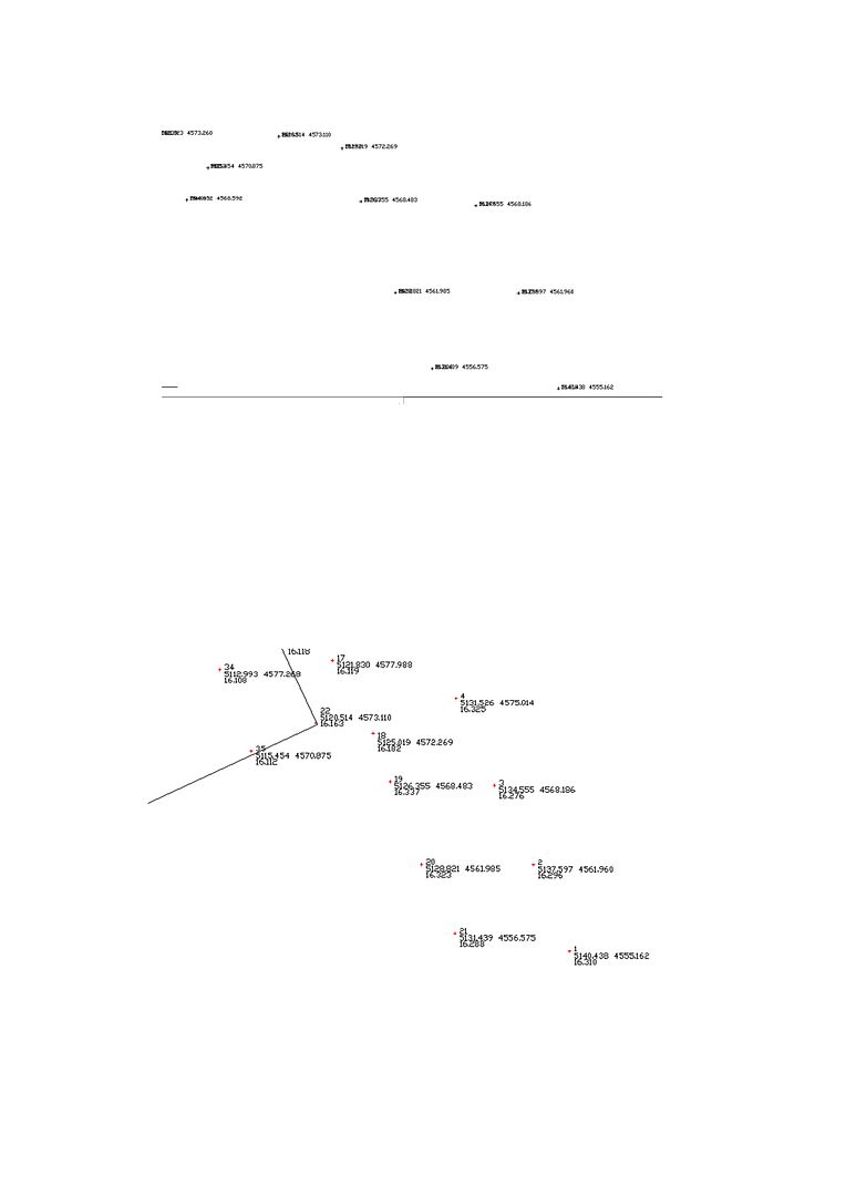
The top picture is what it looks like when I open the DXF file, and the bottom picture is what I want it to look like.
|
Posted By: John Connor
Date Posted: 03.Jul.2015 at 00:18
|
Yeah, repeating basically what you previously said is not very helpful. I understand that the point ID, N/E coordinates, and elevation are all at the same elevation. I get that. I can't think of a way, at the moment to bring them in at the proper heights. ------------- "Humans have a strength that cannot be measured. This is John Connor. If you are reading this, you are the resistance." <<AutoCAD 2015>> |
Posted By: tmire
Date Posted: 03.Jul.2015 at 00:29
|
Just thought I might not have explained it well so tried to word it differently....not sure what you are talking about with regards to the same elevation, the values are stacked on each other and I am have manually move them down so they become visible as in the second picture. |
Posted By: John Connor
Date Posted: 03.Jul.2015 at 12:13
|
I don't see any picture. Upload a copy of the drawing or use a file sharing service like Dropbox. Are you expecting the elevation to be inserted at the actual "Z" in AutoCAD or not? ------------- "Humans have a strength that cannot be measured. This is John Connor. If you are reading this, you are the resistance." <<AutoCAD 2015>> |
Posted By: tmire
Date Posted: 03.Jul.2015 at 12:19
|
I can see the image, it's in my third post and this shows the difference. No don't need it at actual "z" |
Posted By: John Connor
Date Posted: 03.Jul.2015 at 12:41
|
I don't know why all your text is stacked on top of each other. You're either going to have to move it manually or import the data into a program that actually knows how to display it properly. ------------- "Humans have a strength that cannot be measured. This is John Connor. If you are reading this, you are the resistance." <<AutoCAD 2015>> |
Posted By: tmire
Date Posted: 03.Jul.2015 at 12:44
| Yeah I might try that thanks |