


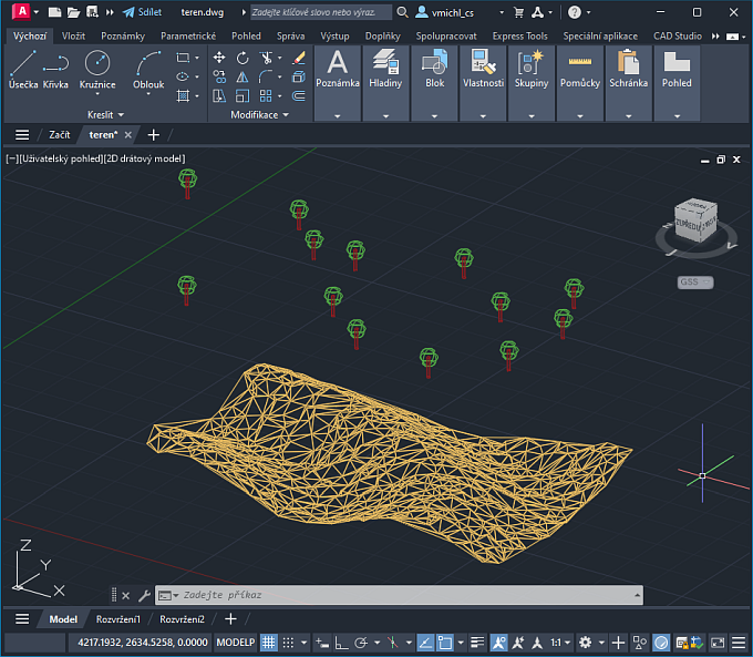
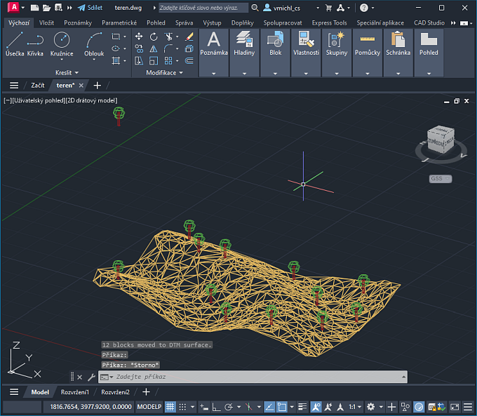
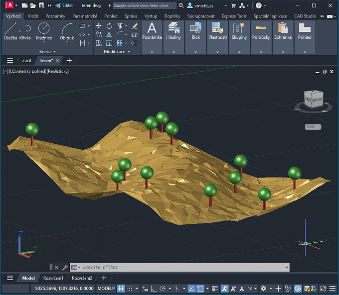
 CAD tip # 14056:

|
| Question | CAD % platform category |
||||||||
|---|---|---|---|---|---|---|---|---|---|
|
|
||||||||
") AutoCAD
AutoCAD| See also: | |
| Tip 11511: | Assigning elevations to 2D contours (isolines). |
| Tip 11054: | Difference volume (3D solid) between two TIN surfaces (sets of coordinates) |
| Tip 9917: | Cannot create terrain model from attached point cloud in AutoCAD Civil 3D 2015. |
| Tip 9625: | How to color 3D topo surface model by slope? |
| Tip 8406: | How to color 3D topo surface model by elevation? |
Have we helped you? If you want to support the CAD Forum web service, consider buying one of our CAD applications, or our custom software development offerings, or donating via PayPal (see above).
You may also add a link to your web - like this "fan" link:
|
|
|
Featuring: Add .CIT raster format support to AutoCAD and Map and Civil 3D CITin 
|
Please use these tips at your own risk.
Arkance Systems is not responsible for possible problems that may occur as a result of using any of these tips.
|
Arkance Systems CZ s.r.o. (CAD Studio) - Autodesk Platinum Partner & Training Center & Consulting Services Partner
|
CONTACT:
webmaster.cz@arkance-systems.com tel. +420 910 970 111 |
||
| Copyright © 2024 | Advertise with us | Online privacy |
| ||
