![CAD Forum - tips, tricks, discussion and utilities for AutoCAD, Inventor, Revit and other Autodesk products [www.cadforum.cz]](../common/arkance_186.png "CAD Forum - tips, tricks, discussion and utilities for AutoCAD, Inventor, Revit and other Autodesk products [www.cadforum.cz]")
CAD FORUM - TIPS & TRICKS | UTILITIES | DISCUSSION | BLOCKS | SUPPORT | HELP & ASSISTANCE

Over 1.096.000 registered users (EN+CZ).
AutoCAD tips, Inventor tips, Revit tips.
Try the new precise Engineering calculator and the updated Barcode generator.
New AutoCAD 2026 commands and variables.
 CAD tip # 13296:
Question
A
You can easily import a standard KML or KMZ file from Google Earth, from twiGIS or from other sources into your AutoCAD Map 3D or Civil 3D.
The presumption is that the coordinate system is set correctly in your map (DWG drawing). To load points or boundaries or polygons from KML, do the following:
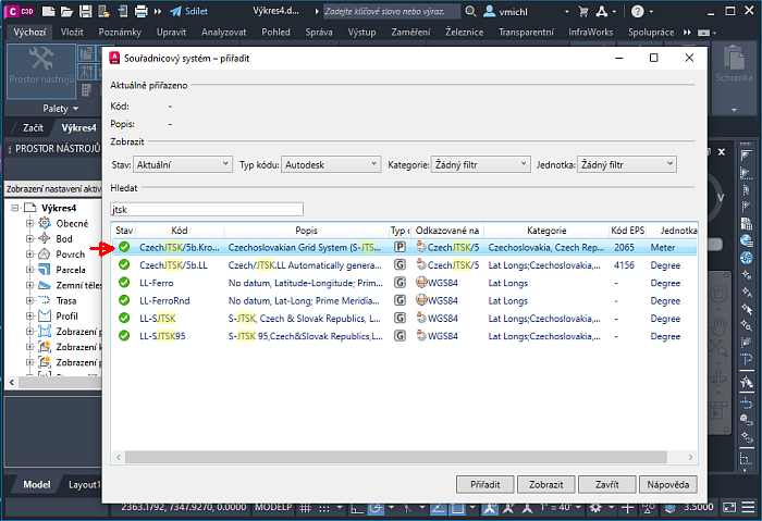
- Use the command MapCSassign (GeoCSassign) to set the correct coordinate system for projection ("P"). Use any standard system used in your local country or area. Here "JTSK" used in Czechia:
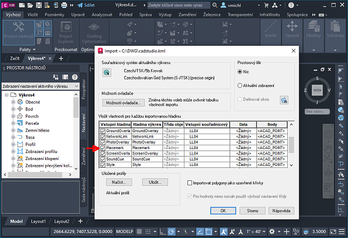
- Now you can use the command MapImport to read in your KML or KMZ file (choose the OGC format KML/KMZ). Imported points will be in the layer Placemark.
- You can tweak the point display style with the variables PDMODE / PDSIZE.
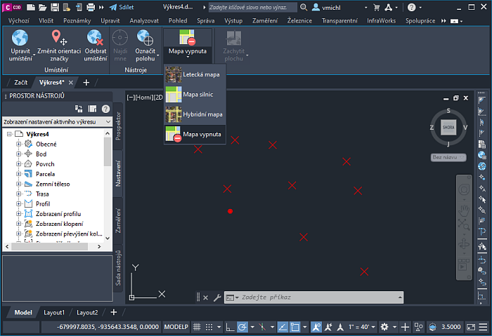
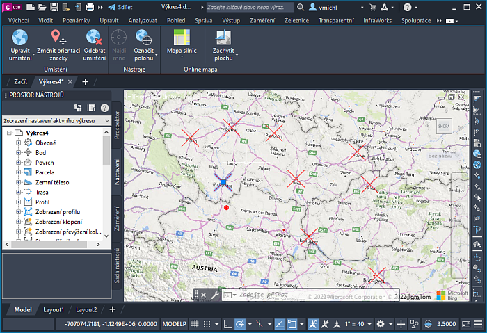
- Now you can enable the underlay map from the ribbon tab "Geoposition", to check the geographic position of the imported geometry. Do not use map positioning from this ribbon. A KML file containing addresses/positions of Arkance Systems offices in Czechia, Slovakia and Hungary was used in this example.
A frequent problem in this workflow is wrong assignment of geographic (not projected) coordinate system and arbitrary setting (by mouse clicking) of its reference point, origin.
MapCivil
16.4.2022
53546×
applies to: AutoCAD Map 3D · Civil 3D ·


CADforum
Tips, tricks, utilities, help, how-tos and FAQ for AutoCAD, LT, Inventor, Revit, Map, Civil 3D, Fusion, Forma, 3ds Max and other Autodesk software (community support by ARKANCE). See About CADforum.
Copyright © 2025 | Advertise with us | Online privacy